Posts

Showing posts with the label oxfordshire

3. The Cambrian Way OEX bush pro Bivvi wet sleeping bag no mat in strong rain and wind The Blorenge.

Image
Day Three on the The Cambrian Way mountain trail 479 km (298 miles) with a total ascent of 22,460 m (73,700 ft). I think it could be Britain's hardest long distance trail. Its hard to say but looking at the map i think i started todays episode around the Mynydd Garnclochdy area i want give exact camping locations away. I was so wet from the rain all night i set about getting ready to walk around 4am just to keep warm. I was no risk at cold from the time of Year and in good health. So walked back up towards Mynydd Garnclochdy i think. The rain came back on top the hill. The rain was very bad so much so i could only see about couple of meters ahead what with the mist as well as the dark even with two powerful lights. By this time my cannon camera was destroyed by the weather i should know by now and my phone was useless take note people think phone navigation fine lucky i know this i used my garmin fenix3 gps watch with the track loaded onto so i knew i was heading in the general dir...

Wittenham Clumps Mother Dunch's Buttocks Wild camp lighting storm and sunrise

Image
Wittenham Clumps is the name for a pair of wooded chalk hills in the Thames Valley near Little Wittenham. Round Hill, is 120m above sea-level. Castle Hill site of an Iron Age hill fort is 110 m above sea-level. not normally considered one of The Clumps, is Brightwell Barrow, further to the south-east. The summits are wooded by the oldest beech tree plantings in England from 1740s. North slopes overlooking villages and towns whose sites of the first settlements of the English. The Clumps are the most visited outdoor site in the county of Oxfordshire, attracting over 200,000 visitors a year. Wittenham Clumps are near to the River Thames, and good views can be had from the Thames Path along the river. The white-walled reactor buildings of the Joint European Torus, site of the world's first successful controlled nuclear fusion experiments, can be seen around 6 km to the north-west from the clumps. The hillfort on Castle Hill. The earliest earthworks date to the late Bronze Age. In ...

A ancient British frontier border wild camp with a laptop digital hobo o...

Image
Linear Earthwork, Tribal Boundary and Ritual Beheading: Aves Ditch from the Iron Age to the Early Middle Ages @ https://amzn.to/2ZuYexM Aves Ditch is one of the best-preserved and yet most enigmatic of the ancient monuments in Oxfordshire, and it has remained a landmark to the present day. Lined by a straight row of trees, it can be seen over a fair distance. It runs virtually dead straight over no less than 4.2 km from north of Kirtlington to the modern parish boundary between Upper Heyford and Middleton Stoney. For over three centuries scholars have wondered whether it is of pre-Roman, Roman or Anglo-Saxon origin, whether it was a road or a linear earthwork and, in the latter case, what function it may have served. Notwithstanding this centuries-old debate and it being easily accessible just 15 to 22 km north of Oxford, it is also one of the least known of the county's visible archaeological features and is seldom referred to in popular or scholarly work on the history or a...

War Memorial & tree

Image
War Memorial & tree The Chiltern Way Cookley Green Oxfordshire England UK www.4seasonbackpacking.co.uk

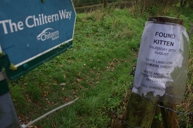
Found kitten on The Chiltern Way

Image
Found kitten on The Chiltern Way The Chiltern Way Ewelme Oxfordshire England UK www.4seasonbackpacking.co.uk

The flying of model aircraft is forbidden sign drone fans

Image
The flying of model aircraft is forbidden sign drone fans The Chiltern Way Russell's Water and Maidensgrove Commons Oxfordshire England UK www.4seasonbackpacking.co.uk

Prison property Danger keep out deep water

Image
Prison property Danger keep out deep water The Chiltern Way Nuffield Oxfordshire England UK www.4seasonbackpacking.co.uk

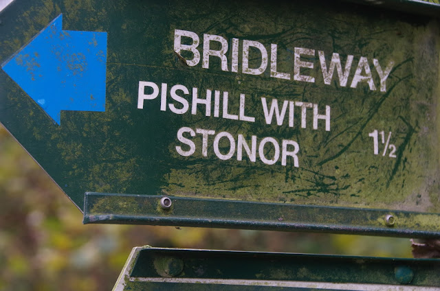
Pishill with Stonor sign on Chiltern Way

Image
Pishill with Stonor sign on Chiltern Way The Chiltern Way Russell's Water South Oxfordshire England UK www.4seasonbackpacking.co.uk

Warning dangerous dogs in Denton sign

Image
Warning dangerous dogs in Denton sign Oxford Green Belt Way. Oxford Oxfordshire England UK www.4seasonbackpacking.co.uk

River thames in Oxford

Image
River thames in Oxford Oxford Green Belt Way. Oxford Oxfordshire England UK www.4seasonbackpacking.co.uk

Hawk Stone "Hawkstone". Standing stone.

Image
Hawk Stone "Hawkstone". Standing stone. May be a neolithic standing stone that may have been put here by humans 6000 years ago. Date remains unknown. The reason for it remains unknown. Local tradition has it that the cleft in the top of the stone was made by the chains of witches who were tied to the stone and burnt alive In the opinion of some earlier historians, the Hawk Stone formed an integral part of a stone circle here, but there is little known evidence to substantiate this Tom Graves’ (1980) was doing some dowsing experiments at the Rollright stone circle a few miles west, he found what he described as an ‘overground’ (or ley) linking the ring of stones to the Hawk Stone, but no other connecting sites are known along this line. Spelsburydown Farm. Dean, Oxfordshire, England. UK www.4seasonbackpacking.co.uk