Posts

Showing posts with the label ruins

3. The Cambrian Way OEX bush pro Bivvi wet sleeping bag no mat in strong rain and wind The Blorenge.

Image
Day Three on the The Cambrian Way mountain trail 479 km (298 miles) with a total ascent of 22,460 m (73,700 ft). I think it could be Britain's hardest long distance trail. Its hard to say but looking at the map i think i started todays episode around the Mynydd Garnclochdy area i want give exact camping locations away. I was so wet from the rain all night i set about getting ready to walk around 4am just to keep warm. I was no risk at cold from the time of Year and in good health. So walked back up towards Mynydd Garnclochdy i think. The rain came back on top the hill. The rain was very bad so much so i could only see about couple of meters ahead what with the mist as well as the dark even with two powerful lights. By this time my cannon camera was destroyed by the weather i should know by now and my phone was useless take note people think phone navigation fine lucky i know this i used my garmin fenix3 gps watch with the track loaded onto so i knew i was heading in the general dir...

England Scotland Anglo-Scottish border patrol Cornhill-on-Tweed woods to Union Bridge woods

Image
I had a good sleep on a right of way path in woods by Cornhill-on-Tweed. After getting the tent down i was on my way to Cornhill-on-Tweed village where i got the best spicy pie ever. Really recommend getting one if your in the area. I made my way along the A698 road and accross the Anglo-Scottish border river tweed bridge into Scotland and Coldstream i made a slight detour to goto the co op supermarket there. Then after my visit i made my way towards Lennel on the A6112 road. I had a look around Lennel Old Parish Church ruins. Then it was more walking along the A6112  then onto the B6470 to the spring near Ladykirk Church. i crossed the Anglo-Scottish border bridge over the river tweed into Norham and to see Norham Castle. After a walk along the tweed i arrived at Horncliffe. I wild camped in woods near Union Bridge. The Baa Green The border between Scotland and England runs down the middle of the River Tweed, however between the villages of Wark and Cornhill the Scottish bor...

Castle Acre Priory ruins

Image
Castle Acre Priory ruins The Peddars Way Norfolk England UK www.4seasonbackpacking.co.uk

Thetford Priory ruins

Image
Thetford Priory ruins The Peddars Way Thetford Norfolk England UK www.4seasonbackpacking.co.uk

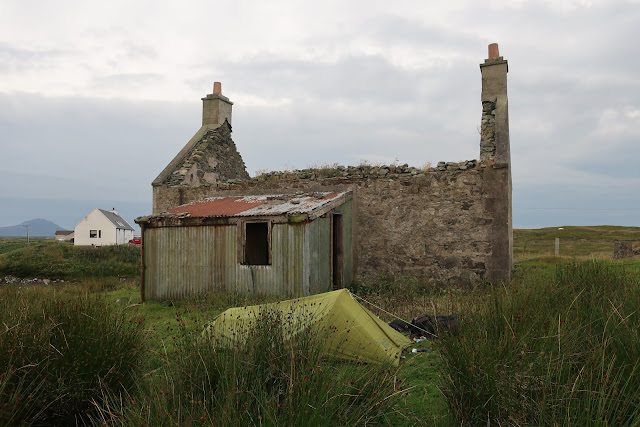
Wild camping by a croft ruins on The Hebridean Way

Image
Wild camping by a croft ruins on The Hebridean Way The Hebridean Way The Outer Hebrides Western Isles The highlands Scotland UK www.4seasonbackpacking.co.uk

Teampull na Trionaid ruined 13th century trinity church

Image
Teampull na Trionaid ruined 13th century trinity church The Hebridean Way The Outer Hebrides Western Isles The highlands Scotland UK www.4seasonbackpacking.co.uk

Abandoned croft ruins on south Uist

Image
Abandoned croft ruins on south Uist The Hebridean Way The Outer Hebrides Western Isles The highlands Scotland UK www.4seasonbackpacking.co.uk

Ancient Buddha ruin at Wat Mahathat temple.

Image
Ancient Buddha ruin at Wat Mahathat temple. Sukhothai Historical Park. Kao, Sukhothai Thailand www.4seasonbackpacking.co.uk

Ancient Buddha ruin at Wat Mahathat temple

Image
Ancient Buddha ruin at Wat Mahathat temple. Sukhothai Historical Park. Thailand www.4seasonbackpacking.co.uk

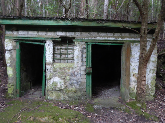
Hut ruins

Image
Hut ruins Mount wellington Fern tree Hobart Tasmania Australia www.4seasonbackpacking.co.uk

Sheep at Burrow Mump St Michael's Church Ruins

Image
Sheep at Burrow Mump St Michael's Church Ruins Macmillan Way West Path. Somerset levels England. UK www.4seasonbackpacking.co.uk

Swing bridge ruins over Hooe Lake.

Image
Swing bridge ruins over Hooe Lake. Completed in 1887 and closed in 1963. The south west coast path The England Coast Path Plymouth. Devon. England. UK www.4seasonbackpacking.co.uk